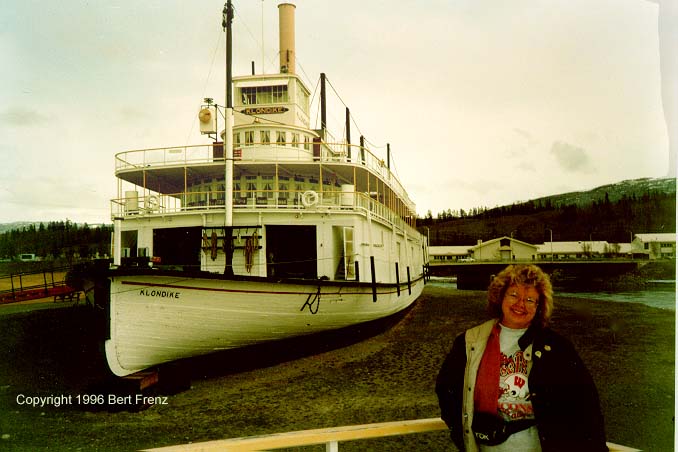
Day 45 - Wednesday, May 15 - Milepost 4593 - Birdcount 220 - Whitehorse, Yukon Territory
(SF's Journal). Young Creek, abandoned building, Continental Divide, Pine Lake (with snow cover), Swift River Bridge, Steep Hill westbound, microwave tower access road, turnout both sides of highway with litter barrel - such are the descriptions in The Milepost for today’s journey. We travel 281 miles through country populated by spruce, spruce and more spruce and just about nothing else except rain that looks white. By contrast, Whitehorse, population 21,000 looks like New York City to me. Our home for the evening is Trail of 98 RV Park (4/7/5). It is on a hill above the city and is pretty junked up but nothing else is open yet. Even the city information center does not open until the weekend. We are at the leading edge of the birds, the buds on the trees, the crowds and the opening of attractions. The campground provides a hose and water to wash R TENT and the car. After we complete that filthy task we head to town and have film developed, buy a sweatshirt and do some grocery shopping.
(BF's Journal). The first 75 miles of our trip west along the lower border of the Yukon Territory is like driving through a 40-ft deep trough as wide as a football field is long, with the 50-yard line as the highway’s center stripe, and bordered every three feet with barren telephone poles crowned with spruce and pine needles. The land is gently rolling and the road is straight so we cruise at 55 mph. On the few occasions when we see above the trough’s boundary, our perspective shows we are in a broad valley hemmed by smoothly rounded snow covered mountains and our "telephone poles" are really a continuous mat of yellowish green White Spruce and Lodgepole Pine. At 10 AM we break out of our trough as we near the Continental Divide and can again see long distances filled with endless forests and purple mountain majesties. Unlike the Lower 48 where water flows either to the Atlantic or Pacific Oceans, here the Continental Divide splits streams flowing to the Pacific or the Arctic Oceans. As we thread our way along the Rancheria River we again encounter snow flurries, but they cause little difficulty because this time they melt upon contact. Instead, we are slowed by highway construction when we crawl through several ten-mile stretches of gravel, both the hardened flat type and the stone-throwing washboard grade. About 30 miles outside Whitehorse, we again encounter civilization. Cottages built along the lake, hunting and fishing lodges and signs proclaiming the sites and shops in Whitehorse provide evidence that this city is geared for tourism during its brief three-month summers. One wonders what the locals do between September and May, however.
![]() Next
Day
Next
Day ![]() Itinerary
Itinerary